16 April 2012

From Las Vegas to Lake Powell, April 16, 2012


Artwork at McCarran International Airport in Las Vegas, Nevada, April 2012. (Photo by Daniel Binkard)

Artwork at McCarran International Airport in Las Vegas, Nevada, April 2012. (Photo by Daniel Binkard)

Panorama at McCarran International Airport in Las Vegas, Nevada, April 2012. (Photo by Daniel Binkard)

Clouds over Coconino County, Arizona, April 2012. (Photo by Daniel Binkard)

Clouds over Kane County, Utah, April 2012. (Photo by Daniel Binkard)

Clouds over San Juan County, Utah, April 2012. (Photo by Daniel Binkard)

Lake Powell at Glen Canyon National Recreation Area, April 2012. (Photo by Daniel Binkard)

Lake Powell horseshoe bend at Glen Canyon National Recreation Area, April 2012. (Photo by Daniel Binkard)

Streambed in San Juan County, Utah, April 2012. (Photo by Daniel Binkard)

15 April 2012

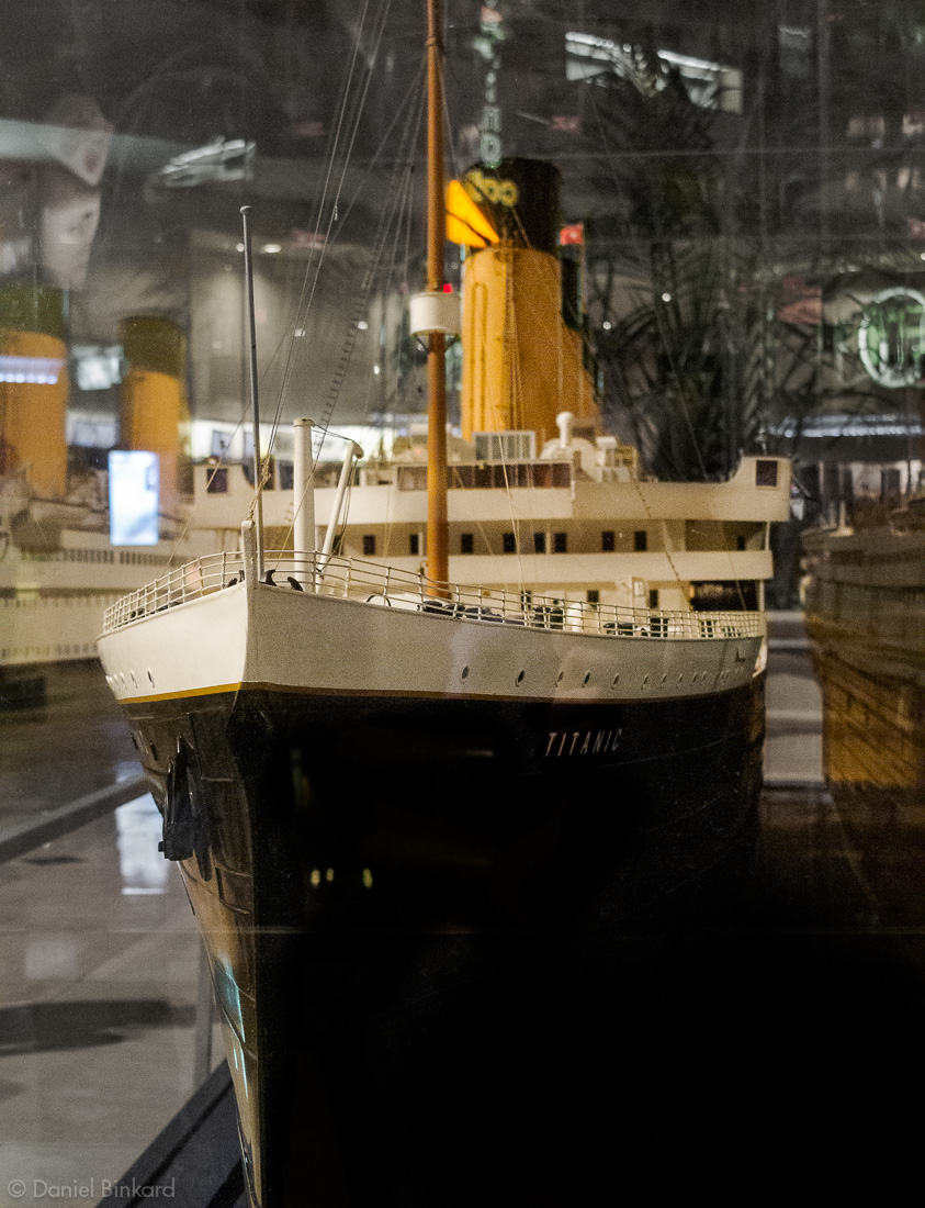
Titanic, April 15, 2012

Titanic model at the Luxor, Las Vegas, Nevada, April 2012. (Photo by Daniel Binkard)
The Luxor has a great exhibit about the Titanic, and a big model of the ship in the lobby. I can't countenance pulling personal artifacts from an ocean grave, but I took a look. One hundred years, almost to the day, since the sinking, and it's a haunting experience to look at the iron hull, the china, and the personal effects of people who died there.

Evening in Las Vegas, April 15, 2012


Buildings and clouds in Las Vegas, Nevada, April 2012. (Photo by Daniel Binkard)

Buildings and clouds in Las Vegas, Nevada, April 2012. (Photo by Daniel Binkard)

Waterfront and structures at the Bellagio in Las Vegas, Nevada, April 2012. (Photo by Daniel Binkard)

Contrail viewed from the Bellagio, Las Vegas, Nevada, April 2012. (Photo by Daniel Binkard)

Evening sidewalk in Las Vegas, Nevada, April 2012. (Photo by Daniel Binkard)

14 April 2012

Clouds over Coconino County, Arizona, April 14, 2012

Clouds over Coconino County, Arizona, April 2012. (Photo by Daniel Binkard)
I don't always fly, but when I do I try to take photos. The first time I went up in a plane at age six, I was entranced by the thick clouds when we rose above them. I thought it was snow at first. Clouds continue to fascinate me, and this photo is mostly about clouds. I like the sense of scale shown by the similar cloud shapes as they recede into the distance. The empty spot in the middle, showing some of the Arizona landscape, keeps the scene from being just about clouds.

Aerials from Nebraska, New Mexico, Arizona, April 14, 2012


Clouds over Scotts Bluff County, Nebraska, April 2012. (Photo by Daniel Binkard)

Clouds and sun over Scotts Bluff County, April 2012. (Photo by Daniel Binkard)

Cloud formations over Banner County, Nebraska, April 2012. (Photo by Daniel Binkard)

Irrigation circles, rocks, and roads in San Juan County, New Mexico, April 2012. (Photo by Daniel Binkard)

Aerial view over Navajo County, Arizona, April 2012. (Photo by Daniel Binkard)

Clouds over Coconino County, Arizona, April 2012. (Photo by Daniel Binkard)

Bartlett Reservoir in Maricopa County, Arizona, April 2012. (Photo by Daniel Binkard)

Clouds over Yavapai County, Arizona, April 2012. (Photo by Daniel Binkard)

Lake Mohave in Mohave County, Arizona, April 2012. (Photo by Daniel Binkard)

25 March 2012

Aerial Views Around the Oglala National Grassland, March 25, 2012


Farmland in Dawes County, Nebraska, March 2012. (Photo by Daniel Binkard)

Aerial view of Roundtop in the Oglala National Grassland, March 2012. (Photo by Daniel Binkard)

Badlands near Toadstool Geological Park, March 2012. (Photo by Daniel Binkard)

Cliffs near Roundtop in the Oglala National Grassland, March 2012. (Photo by Daniel Binkard)

Sand Creek in the Oglala National Grassland, March 2012. (Photo by Daniel Binkard)

Afternoon sunlight shows the Oglala National Grassland landscape in strong relief, March 2012. (Photo by Daniel Binkard)

Badlands near Toadstool Geological Park, March 2012. (Photo by Daniel Binkard)

Aerial view of Toadstool Geological Park, March 2012. (Photo by Daniel Binkard)

Ridgeline including Crow Butte and Little Crow Butte, March 2012. (Photo by Daniel Binkard)

Aerial view of Crown Butte in the Nebraska National Forest, March 2012. (Photo by Daniel Binkard)

Barrel Butte, Crow Butte, Little Crow Butte, and distant Red Cloud Buttes, March 2012. (Photo by Daniel Binkard)

East Ash Creek in Dawes County, Nebraska, March 2012. (Photo by Daniel Binkard)

Farmland contours in Dawes County, Nebraska, March 2012. (Photo by Daniel Binkard)

“I couldn’t swear to every detail but it’s certainly true that it is a story.”

Afternoon sunlight shows the Oglala National Grassland landscape in strong relief, March 2012. (Photo by Daniel Binkard)

Sand Creek tributary in the Oglala National Grassland, March 2012. (Photo by Daniel Binkard)

Oglala Grassland Badlands, March 25, 2012

Afternoon sunlight shows the Oglala National Grassland landscape in harsh relief, March 2012. (Photo by Daniel Binkard)
An evening flight over the Oglala National Grassland and Toadstool Geologic Park badlands. This is film, I think Tri-X pushed to EI 800 and developed in Diafine. The lighting and striations in the rocks create a beautiful graphite look. I pushed the contrast a bit more in post processing to heighten the impact of the blacks and whites. There is plenty of detail in a scene like this, and it holds up pretty well close up, considering it's film and push-processed.